Autonomous vehicle engineering, grounded in vehicle dynamics.
Priori Dynamics is an engineering consultancy for autonomous vehicles: perception, localization, mapping and sensor integration, backed by race-car vehicle dynamics experience. We also map sites end to end and deliver HD maps ready for Autoware.
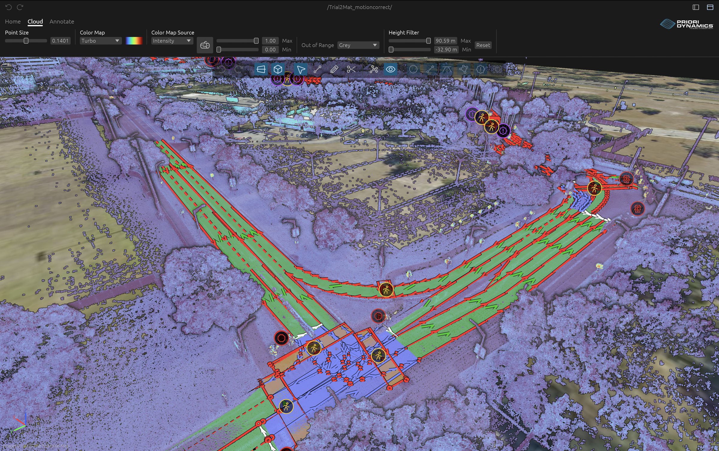
Figure 1. PSTA’s bus yard: 403,261 points sampled from the 34-million-point map, with its Lanelet2 lanes in orange.
Services
What we work on
We test on an instrumented 2025 Mustang GT, with LiDAR, stereo cameras and edge compute on board.
- Autonomous vehicles
- Perception, localization and HD-map pipelines, on Autoware and ROS 2 or standalone on edge hardware. Sensor integration and calibration for LiDAR, stereo cameras, GNSS/INS and IMUs.
- Vehicle dynamics and race engineering
- Vehicle models and parameter estimation, chassis and suspension setup, and data acquisition from CAN and onboard sensors, correlated with track testing and driver feedback.
- Mapping
- HD maps end to end: LiDAR capture, SLAM point clouds, dynamic object removal, Lanelet2 annotation and Autoware delivery. How we map a site
- Research programs
- Technical partner on SBIR and STTR proposals and research programs, and algorithm licensing for primes and integrators.
Approach
a priori (adj.): knowledge derived from known truths through reasoning from first principles.
Start from what is already known.
A priori means known before experience. A car’s motion already obeys a short list of equations, the same ones a race engineer uses to set up a chassis. Most autonomy stacks still learn that behavior from data, and spend compute and test miles rediscovering it.
We write the physics down first and use data for what it leaves open, like mass, center-of-gravity position, yaw inertia and tire cornering stiffness. The method is the same whether the goal is a faster lap or an autonomous vehicle that knows its own limits.
Mapping
Mapping as a service
We map your site with our own LiDAR and cameras, build the SLAM point cloud, remove the traffic that was moving through it and draw the Lanelet2 lanes and traffic rules. You get a map your autonomy stack loads as is. 575,976 m² mapped so far.
Industries
Where we work
- Motorsport
- Chassis setup, data analysis and vehicle models for race teams and track programs.
- Autonomous vehicles and transit
- Bus yards, shuttles and research vehicles, where the HD map defines where a vehicle is allowed to go.
- Defense
- High-speed, contested environments, including the peri-urban transition zone where standard perception breaks down.
- Off-road
- Unstructured terrain with degraded GPS and no map to rely on.
Contact
Talk to us
We work with race teams, autonomous vehicle developers, transit agencies, universities and defense programs. Tell us about the vehicle, the problem and the timeline.